


Day one
Conwy Castle to Nant Gwynant
49km (30.5 miles) | 3800m (12,467ft)
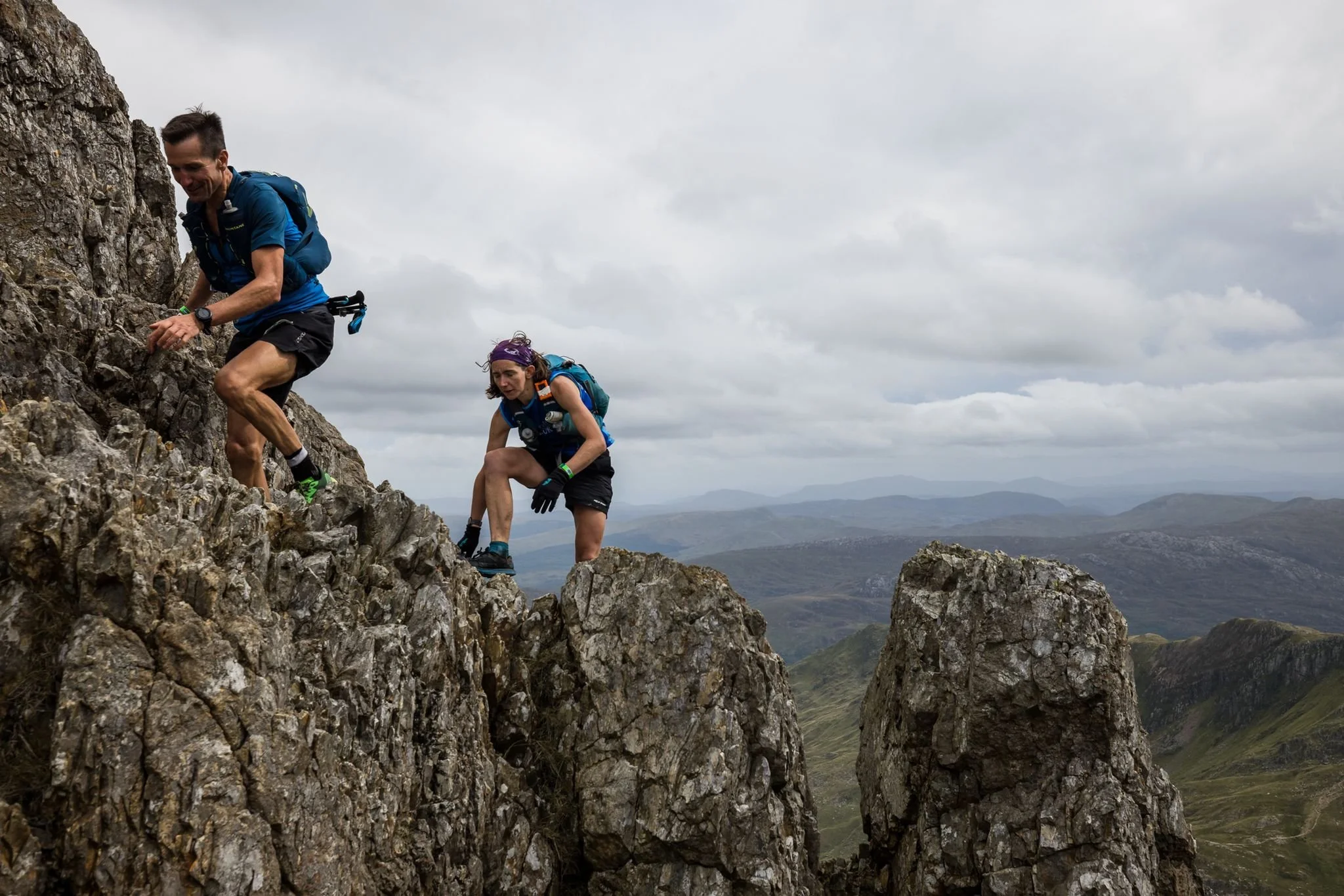
Northern Snowdonia has the rockiest mountains! The Carneddau, Glyderau, and Yr Wyddfa (Snowdon) massif await.
Hatchling course?
Start to support point (Ogwen Valley) – 29km | 1800m
OR
Start to water point (Pen-y-Pass) – 37km | 2800m
Starting with a gentle climb from the beautiful coastal Conwy Castle, the route gradually becomes rockier with unrelenting ascent and descent, culminating in the airy ridge scramble across Crib Goch and the traverse of the full Yr Wyddfa horseshoe, passing by some astounded tourists.
8 Tip
Click/tap on "Learn more" then expand the map to get more route details.
Cut-off times
- Support point (Ogwen Valley - CP 5) cut-off time is 14:00
- Pen-y-Pass (CP 8) cut-off time is 16:40
- Pyg Track path junction before Yr Wyddfa (Snowdon) (CP10) cut-off time is 19:00
Guidance times
(These are best viewed on the race map issued at registration but included here for your convenience)
START 06:00 / CP 1 06:50 / CP 2 08:10 / CP 3 10:00 / CP 4 11:35 / CP 5 13:00 / CP 6 14:00 / CP 7 15:30 / CP 8 16:40 / CP 9 17:50 / CP 10 19:00 / CP 11 19:15 / CP 12 21:00 / FINISH 22:00
Following the route
Please see our guidance on following the route for information about mandatory/recommended sections, how to best access the digital version of the route (including information about GPX files), and what to expect from the event map issued at registration
IMPORTANT: exploring the route pre-event
Please see our guidance on exploring the race route pre-event for information. Note that some sections of the route are private – we arrange special access for the event, and you jeopardise the future of the event if you access these sections at other times. Full information is available in the guidance article.
Get a step ahead with the official event map
Aspirant participants are invited to purchase a copy of last year's event map. An ideal companion for those who prefer a tangible map to spread out on the coffee table to pour over during the build up to the event. Glean extra information about the route (subject to small changes) and familiarise yourself with the layout and style of this bespoke map ahead of being issued yours at registration.
Day one terrain type
Get a full flavour of day one from our race footage

video cover photo ©No Limits Photography